
We also create clear, easy-to-use farm maps for everyday use.
$299 + GST (farms up to 250 ha) larger areas priced accordingly.
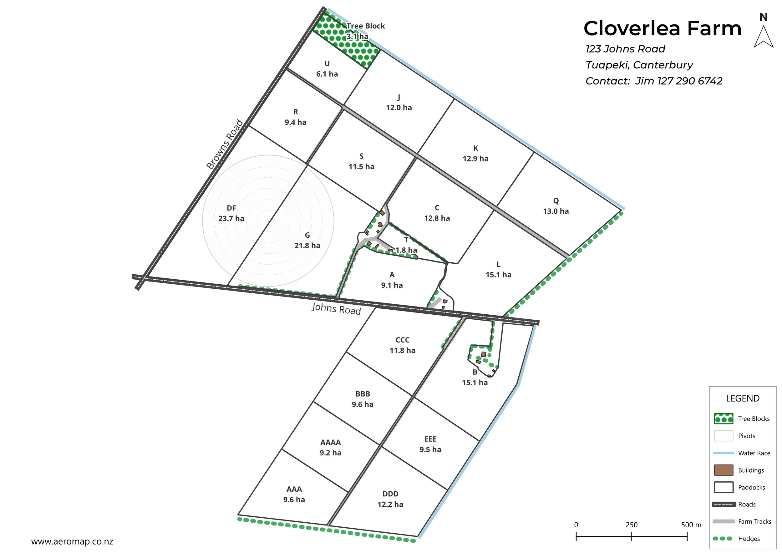
Each map shows:
• Paddock boundaries with names
• Accurate paddock areas (ha)
• Clean layout for quick reference
Designed to be used on-farm — whether that’s for contractors, staff, or planning work.
Delivered as:
• PDF maps
• Printable versions
• Digital files if needed
Simple, accurate, and ready to use.
Optional extras
Tear-off map pads for contractors
Custom layouts if needed
Built by someone who knows how farms actually run - not just drawn on a screen
Farm Mapping Process
Farm maps are created by outlining your paddocks and key features using up-to-date aerial imagery.
Maps are checked and adjusted to match your farm layout, including boundaries, races, and any key features you want included.
Once you are happy with the draft map you will be sent the final files.
Need a farm map done?
Send through:
Farm location
Approximate area
I’ll confirm pricing and turnaround.
scott@aeromap.co.nz